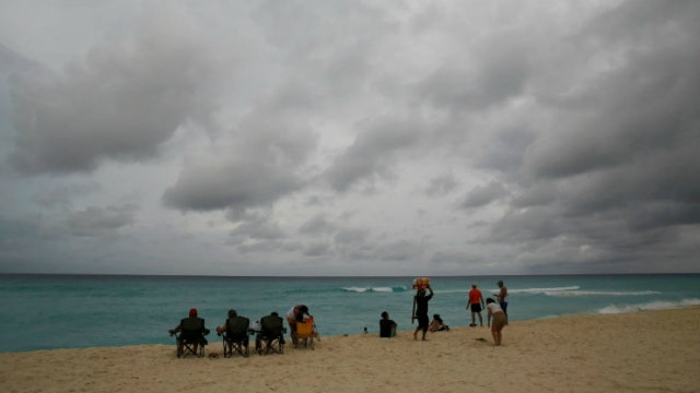
NEW ORLEANS – After battering Honduras and Nicaragua with 80 mph winds and torrential rains that caused an estimated $250 million in damage, Hurricane Nate is rapidly advancing toward the U.S. Gulf Coast.
The storm, which has already been blamed for 22 deaths in Central America, is expected to make landfall as a Category 2 hurricane late Saturday night or early Sunday, prompting states of emergency and evacuations along the coast.
It is expected to make landfall late Saturday in southeastern Louisiana, not far from where Hurricane Katrina landed in 2005. Experts expect that, once it’s course, the storm will have caused as much as $1 billion in damages across the U.S. and Central America, far short of the tens of billions of dollars of destruction wrought by Irma and Harvey.
The storm, packing winds of 85 mph and moving at a speed of 22 mph, is expected to reach category 2 strength before it makes landfall – the third storm to hit the US mainland in six weeks. As a category 2, it’s expected to be weaker than Katrina was when it made landfall as a category 3 in 2005. As of 8 am ET, the storm was 245 miles from the mouth of the Mississippi River, the National Hurricane Center said in its latest advisory. The quick-moving storm was expected to make landfall around Plaquemine Parish in Louisiana, southeast of New Orleans, just like Katrina did.
Storm Nate kills 22 people in Central America before moving towards Mexico, U.S.
Fortunately for residents of New Orleans, Nate’s similarities to Katrina end there. Nate is expected to cause only a fraction of the damage that Katrina wrought (though it wouldn’t be the first time this season that forecasters underestimated a Hurricane’s potential for devastation). Katrina brought a 24- to 28-foot (7.3- to 8.5-meter) storm surge with it that killed 1,800 people and flooded New Orleans. Nate’s surge is forecast to reach four to seven feet.
Like Irma and Harvey before it, meteorologists are amazed by Nate’s speed as it sprinted north-northwest away from Honduras at 22 mph, according to the NHC.

Nate may dump as much as 6 inches of rain across U.S. Gulf Coast states, the eastern Tennessee Valley and southern Appalachians through the weekend, the hurricane center said. Some areas may get 10 inches, according to CNN.
With the memory of Katrina’s devastation still fresh in the minds of many residents, Louisiana has begun mandatory evacuations in areas near the levees in both New Orleans and Plaquemines Parish. President Trump on Friday declared an emergency in Louisiana ahead of Nate and ordered federal assistance to supplement state and local response efforts.
New Orleans leaders issued a citywide mandatory curfew beginning at 7 pm Saturday and continuing into Sunday morning until “the severe weather has passed.”
As Nola.com reports, New Orleans Mayor Mitch Landrieu announced the curfew during a Friday news conference about the coming storm.
I encourage everyone to stay off streets starting tom. at 6 and until we are clear on Sunday, so we can keep you safe.
— Mitch Landrieu (@MayorLandrieu) October 6, 2017
At a certain point, officials expect weather conditions to make travel impossible for first-responders, even in answer to emergency calls.
Beyond New Orleans, some 18 million Gulf Coast residents were under threat as Hurricane Nate powered toward the mainland early Saturday, bringing with it rain and storm surges to parts of Louisiana, Alabama and Florida.
A hurricane warning is in effect for portions of the northern Gulf Coast from Louisiana to Alabama, and preparations to protect life and property should be rushed to completion in these areas,” the hurricane center said. “Life-threatening storm surge flooding is likely along portions of the northern Gulf Coast.” A storm surge warning was in place from Morgan City, Louisiana to the Okaloosa-Walton county line in Florida.
Forecasters expect Nate’s winds will be particularly devastating. The storm’s reach will be wide, CNN meteorologist Chad Myers said, with strong winds affecting population centers from New Orleans to Panama City, Florida. Biloxi, Mississippi, could experience gusts of up to 100 mph as the storm tears down power lines. CNN says it could potentially leave one million people without power between eastern Louisiana and the Florida panhandle., according to Bloomberg.
The storm could also potentially drop 3 to 6 inches of rain, with 10 inches possible in some areas, from the central Gulf Coast north across the Deep South, the eastern Tennessee Valley and the southern Appalachians through Monday, the hurricane center said. Flash flooding like what was seen in Houston and Puerto Rico is a possibility.
The one upside of the storm’s aggressive pace is that it’s expected to pass quickly. Meteorologists expect it will be headed north across the Deep South, the eastern Tennessee Valley and the southern Appalachians.
“Once it hits land, it looks like it’s going to be very quick to move out of the area and then weaken,” CNN meteorologist Jennifer Varian said.
Already, the storm’s impact on commodity markets is shaping up to be similar to the impact that Harvey and Irma had.
Bracing for the storm, governors across the Southeast have declared states of emergency. Florida Governor Rick Scott declared a state of emergency in 29 counties, and 7,000 members of the National Guard have been made available for deployment.
Alabama Governor Kay Ivey issued a state of emergency and advised residents to restock their emergency kits and make an evacuation plan, Russia Today reports.
“By Saturday noon you should be in your safe place,” Ivey told a news conference. “This is a fast-moving storm and we must begin preparing now.”


