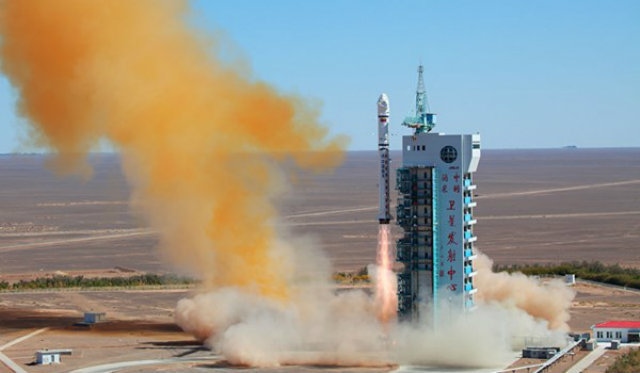
BEIJING – China launched a remote sensing VRSS-2 satellite for Venezuela on Monday from the Jiuquan Satellite Launch Center in country’s northwestern Gobi desert, the state-run media reported.
The satellite was launched at 12:13 local time [04:13 GMT] by China’s Long March-2D carrier rocket. It was the third satellite jointly launched by Beijing and Caracas, the Xinhua news agency reported.
Reports say more than 100 young Venezuelans were involved in its design, structure, and construction.
Venezuelan President Nicolás Maduro said the new satellite will provide a better tool for monitoring agriculture health, energy food, security, socio-natural risk management and security.
“Venezuela is moving forward. We are being beaten, yes, but we are moving forward with work, government and defense of the country,” Maduro insisted.
The VRSS-2 will be used by Venezuela mainly for environmental protection and disaster monitoring, as well as land resources inspection, crop yield estimation and city planning.
The highly sophisticated device is equipped with both high definition and infrared cameras and will monitor regions photographing particular areas every four days.
Officials believe this feature will also be particularly helpful in controlling criminal activity.
In 2008, the first Venezuelan communications satellite called the Venesat-1, or “Simon Bolivar” was launched, while a second one, the remote sensing satellite VRSS-1, was launched into space by Beijing in 2012.


